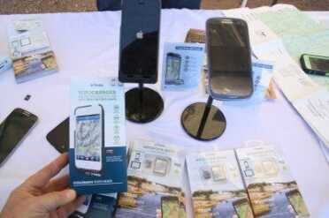
Very few people stopped by the Trimble booth at Media Day at the Range. They are a huge company, from laser scanning to growing sugar cane, and this is a tiny corner of their business. I thought it was nice that they thought enough of us to do a Media Day booth.
Trimble Outdoors Topo Maps for Mobile
Android, Ipad SD Cards: https://www.trimbleoutdoors.com/sdcards/
IPhone TopoCharger (sign up for launch): https://www.trimbleoutdoors.com/TopoCharger/
I have been sitting on a story since Media Day at the Range back in January on the day before the 2014 SHOT Show. It is a very simple GPS driven topography map interface for smartphones and tablets. Who doesn’t have one of those these days right? But outside of a very small percentage of hunters that hunt public lands with topo maps, I didn’t think many people would be interested in our gun world. One detail about these cards, though, makes them extremely relevant for long term survival. They don’t require a network connection to use the GPS or the data. Once you download the app, all you need is the micro-SD card with the data. At $69.99 without private land data and $99.99 with that data, these are a really cheap way to keep right at your fingertips a complete set of topo maps for your entire state. Right now the cards are available for all Android devices and the Ipad, and we were able to fondle the first generation of IPhone charger cases at SHOT Show, though they have yet to be released.
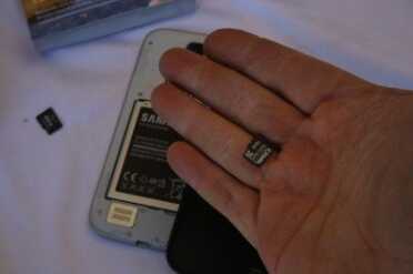
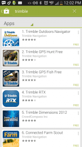
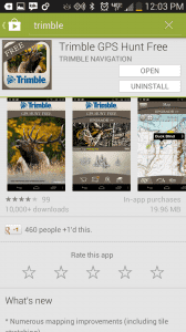
It is a big package for a little chip. That is all you are buying. The apps are for the most part free.
Why do you need a topo map? Well if you plan to survive in a city, you don’t, but the chances of long term survival in a city, without any infrastructure, is either slim or none. If you expect to make it through the coming collapse, you’ll have to find some way to get out of dodge, to where you can draw your own water and hopefully grown some of your own food. That is the country, and if you haven’t developed and stocked a place beforehand, there is a good chance that you’ll be foundering into the woods, hoping to survive with what you can find.
A topo map tells you where the streams and lakes are, where the railroads tracks will provide easy travel, where old logging roads still exist, and they give you rough elevation as well. It really stinks when you get to the top of the big hill then realize you could have just as easily gone around. And if the roads are blocked and patrolled, and you want to circumvent those patrols, a topo map will give you the easiest and safest way around.
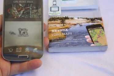
The booth people were kind enough to allow me to install the Nevada maps in my phone. One of the few negatives of this product is that it does burn itself on to the first device you use it with, so you’ll have to take that phone. I don’t know what happens if you lose your phone.
Keeping a cell phone charged is pretty easy compared to a lot of other devices. Even on the cloudiest days a solar charger will charge up your phone, and it is small enough that you can charge it as you travel.
Are you concerned that the powers that be will flag your location with your phone? Could be. But there will most likely be bigger fish to fry, and, as we’ll cover more in our future articles on communications, the government has built a huge network of communications towers nationwide specifically because they expect the cell networks to be down. Regardless, there is no other way to carry so much data on your state in such a small package. These little data cards are really a score from a survival perspective.
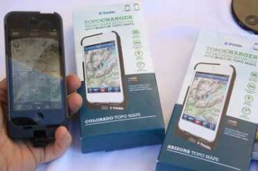
This is the IPhone case. They said it was supposed to be out by now but the site is still showing it as not available.
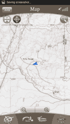
One thing you will notice about the topo map data is that this is not truly digital data. like you see on Google Maps or your car GPS. Topo map cartographers haven’t entered the digital age yet and they are still drawing maps on paper, then photographing the paper. This Trimble project grew out of their MyTopo map printing service. The GPS overlay with the phone does seem to work great though. It pinpointed our location in Nevada just fine.
I guess I am taking for granted that most people already know that the phone GPS maps are not located on your phone. Your phone has a GPS chip, and that chip just sends coordinates to the network. The maps are loaded from Google or Apple, on the fly, and they are not saved. If your phone is not online, you have effectively no GPS, because you have no maps. Your car GPS may, and probably does have its own maps, but they only consist of road data anyway. Obviously Google Earth is just online as well, so again, these topo maps are the only sound solution for being able to figure out where you are and what is around you.
The internet was originally created by the military to be able to withstand a disaster, and partial destruction. The “internet protocol,” or IP, doesn’t need a centralized server to maintain connectivity from any one machine to another machine on the network. But as our public internet has grown, we have relied more and more on single providers, like the cable companies and phone companies, to provide our high bandwidth services. All of these companies rely on regional and local data centers, and when the generators at those centers run out of diesel, the internet will go down.
There was also a recent news story that the Transportation Department wants to begin regulating all map devices, including smartphones and tablets. They actually put it in the new proposed transportation bill, so this isn’t one of those things you never hear about again. That means that the government is trying to grant itself the power to shut off all maps. Crazy stuff! These Trimble products are a great safeguard against being stranded somewhere with no idea where to find water, or how to get to some infrastructure, if any exists.

Let me tell you a story. My company provides gps tracking devices. Quite some time ago, one day, in our capital city, Bucharest, suddenly all our clients started to complain about our GPS devices, they all indicated bad and invalid positions, few hundred units. In other cities and countries, all seemed fine. I was very confused because this was highly unusual, no regular malfunction could cause this. Until I realized what is happening. Exactly in that day, Mr. George W. Bush was visiting Bucharest…
If you think you can rely on a system built for military purposes in a time of war, then good luck… The gps can go offline, if needed, with the push of a button…
Best app while you are on hunting. Can help you know the terrain easily. An important accessory to keep with.
I strongly agree that one needs the basic map and compass skills one should have learned in the Boy Scouts, but topo maps are usually 7.5′ or 15′ quadrangles, and unless you’re walking you’ll quickly drive off into another quadrangle, so for “survival” you’ll have to acquire a large set to carry along, much more than you’d need for hiking or hunting. I haven’t tried any of the map apps listed, but I think it would be great to have all the map data on a single device. In a “survival” scenario you would turn off the Cellular Radio, WiFi, and Bluetooth portions of your cell phone to conserve power and to avoid detection. The GPS receiver doesn’t transmit, although it does take some power. Once you find out where you are on the map you can turn off GPS receiver and orient yourself to the surrounding countryside if there are sufficient landmarks (mountains, rivers, etc.). In fact, that’s what one has to do if you’ve lost your compass. Some places, like Fort Valley in the Shenandoah Valley, make it easier to do that than others, like the middle of a flat desert or plain.
You left the BEST TOPO mapping app off your list! BackCountryNavigator is by day the best app for TOPO maps!
Correct me if I’m wrong but neither the iPhone or iPad has a port for a Micro-SD card so are they technically ignorant or has the marketing department bitten off more than they can chew?
What ever happened to the waterproof topo maps and a compass? We need to lean our basic skills first.
So true. NOTHING to break, NO Battery needed.
You might want to take a look at the app: You Need A Map ($1.99) and Scenic Map ($9.99), which are available on the Apple app for iOS devices like the iphone and iPad. They have been around for a couple of years and include a fully downloaded map (takes 2 GB on your phone/pad) which uses the openmap.org (free) map database. You Need a Map shows topo data and Scenic Map does it in 3D. Scenic map has very detailed maps of major parts of the U.S.
The developer website is at http://scenicmap.blogspot.com/.
Will this only work with the newest iPhones or will it work with older models 3rd or 4th gen? Great review btw when you guys do reviews like this most of the time you hit the nail on the head and review something I can use and have never herd of
To the best of my knowledge none of the iPhones have a data port.
They have a data port but no SD card socket. I went to http://www.trimbleoutdoors.com/sdcards/ and they have directions for loading the software and data onto a MAC or PC and then updating your iPhone with iTunes.
Me, I have a Crackberry, so I’ll have to find an Android tablet w/GPS.
I wouldn’t count on GPS or anything else electronic after a societal collapse.
Plus your phone is still pinging towers constantly (“handshake” signal) so anyone with access to that can actually find you faster than you can find your way out. I buy used handhelds (GPS) on Ebay, preferably ones with Topo maps already loaded. They are passive, won’t at least send out signals. Plus an old school compass is a plus.
old school yep you know I wonder how many to day could land nav if they had to . makes me just chuckle hell 99% will never make it out of the citys let alone to the country . I keep a set of aviation sectionals and a set of hard copy topos and two good compass’s if the marines ever made me do any thing it was get my but when and where i was posed to be on time .
I can say after using this app for the past year that it is great.The gps works perfectly. It is great to be able to add pics and notes of your hunt one feature I did use on return hunts to rember a great hide or vantage spot. My biggest complaint would be that while you can access features like private lands and forest roads you cannot view them in the same overlay, and it is a big battery killer I suggest getting a backup battery case it was very helpful. I would definitely suggest this to anyone looking for new areas to hunt of trying to find open BLM land to plink on.