MyTopo Custom Maps from Trimble
https://www.mytopo.com/search.cfm
Some time ago in this series we covered network-free GPS map product from Trimble for your Apple and Android phones (they still aren’t selling the Iphone one). That product is basically a memory chip containing maps for whatever state you buy, and the phone uses the GPS chip to help you navigate the map. Many people in the comments of that article said “I’d really prefer a printed topo map in a SHTF situation.” And I agree, but when you look at what you get with that product as compared to printed maps, it is a really great buy. For this follow up I decided to look into MyTopo, the $9.95 – $319 printed version of Trimble’s map product, and WOW, you aren’t going to believe how far modern cartography (map making) has come.
If you are shaking your head already and saying $319 for a map?? That must be a misprint! It isn’t. Trimble offers a number of options to add to your map that makes it expensive, and if you print your map at 8 feet by 5 feet in size, at the best resolution, it is indeed $319, plus shipping.
First look at what you get for ten bucks, or really like $16 including the shipping. This is an 18″ x 24″ laminated, rolled up map of the surrounding area to whatever street address or GPS coordinates you enter into the system. Once you put in the address you can use their web program to move the center of the map around to whatever location you want, and you can see the actual terrain as you do it. It’s pretty nifty.
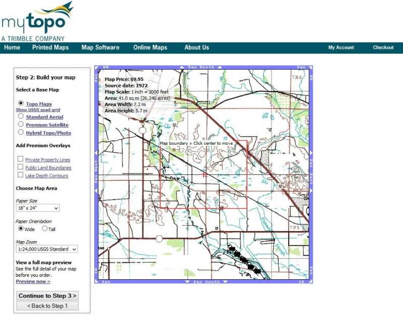
As you can see, I selected just the topo map fo $9.95. It is based on the old printed topo maps we used to buy when we were kids. Many of these date back to surveys done in the 1970s and earlier and besides the elevations, railroads, and streams, they may not even resemble the area for which you require guidance. This map is from 1972, and is missing whole parts of town that have been built since that time. If you upgrade your same sized map to a basic aerial view you will get a satellite picture overlay of the same rectangle, and they are fairly recent, 2010 and newer. That, however, raises the price to $29.95 for the same sized map. .
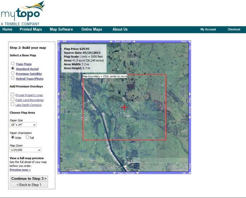
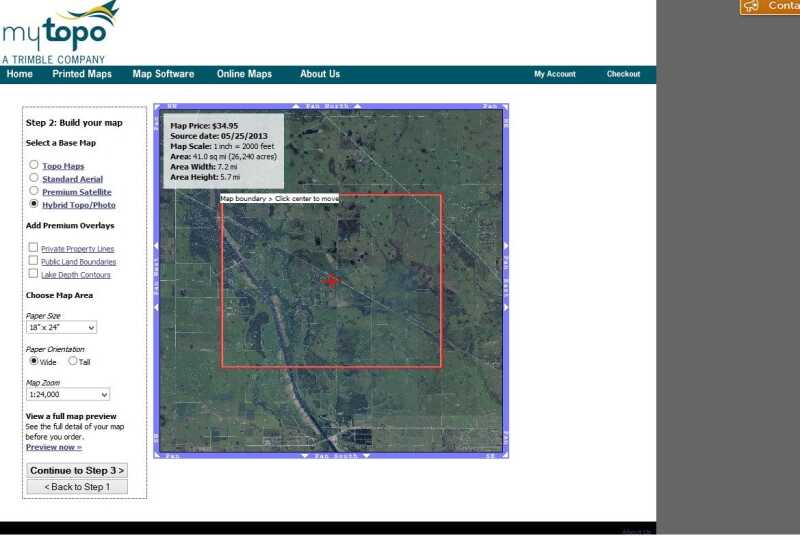
For a hybrid topo-photo, the price comes up to $34.95.
If you want to spend $59.95, you can get a more contrasted and sharper satellite image. This is the best resolution.
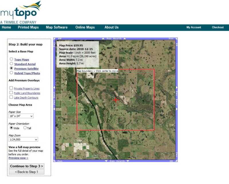
Add private and public property lines, and water depths, and it will raise the price to $79.95. (Is that phone app sounding better by now? It gives you the whole state for that!)
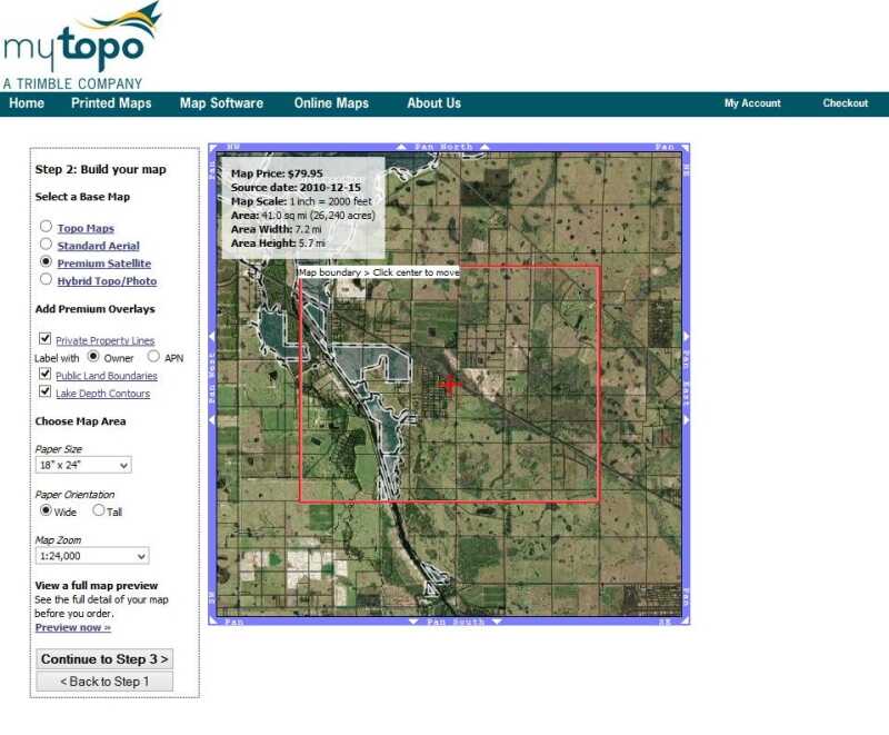
Now, before getting to how we reach $319, I’m going to digress a little bit and talk about scale. The default scale on the MyTopo website is 1:24,000, meaning that you could cover the actual land area on the map with 24,000 of these paper maps laid side to side. That equals 2,000 feet of land per inch of map. I prefer a larger sized map and a scale that is easier to measure with the inch ruler on my compass, so I like the 1:30,000, because one inch is 2,500 feet, or pretty close to half a mile.
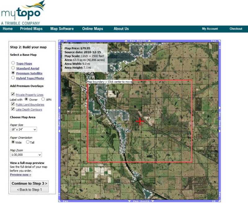
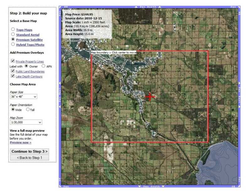
Now you can make the paper map physically larger, but that costs more money. Even 3 feet by 4 feet doubles the price to $144.95.
If you want the 5 x 8 top size, it is indeed $319.95.
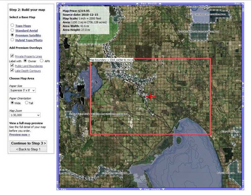
Note that as you make the map bigger, you do actually increase the land size on the map. The 18 x 24 version covered 64 square miles. The $319 map covers 1150 square miles at the same resolution.
Is it worth it? Depends on where you live and how familiar you are with the land around your place, or your bug out location. Safe and dry escape routes could be planned in advance using Google Maps of course, but when you are offline completely, having a waterproof map of your surroundings is a comfort, and because these are recent satellite images, you are going to be relying on fairly fresh data as to where you’ll find houses and roads.
Now that I have received two maps (they shipped same day I ordered), my only negative comment is that they do not have any street names to speak of. I would not just order one of these maps and put it in a corner for “come the day.” I plan to take mine out, lay them on the floor and use a computer with Google maps to mark key streets, highways, lakes and other landmarks that give you an overall perspective of where you are as compared to what you know in the area. I printed both a very rural farm area and a suburb of a major city. The 5′ x 8′ map is cool, but unwieldly and I don’t think I would order one that big again. If you want a big map I would go with the 3′ x 4′ before the larger size. The 24″ x 36″ is a very good size as well. The maps ship rolled, and though they are a little thinner than I expected, they both seem to be printed on either straight polymer or some kind of heavy coated paper that is very resistant to tearing. On the rural one I got the land owners on the map, and in a survival situation I think it will really help to know what is privately owned versus corporate owned for the purpose of hunting and gardening.
Your own situation and area have lots of their own specific conditions, and that is why these maps are a really important component of any prepper’s core toolkit. These maps aren’t perfect, but for he money they are a great investment and I highly recommend taking the time to order one now. Like everything else in this column, the information is here. The costs are laid out. Action is what will improve your chance of survival when this all boils down, and ten years early is better than one day late. I already have my maps.

Trimble maps are okay, and maybe worthwhile for those not experienced with USGS maps.
However, the USGS maps, coupled with the maps one can print out from the most counties used for locating land parcels are much, much cheaper, and the county GIS maps are never more than 12 months old, at least I have not found any older than that.
If you take some classes in map reading, you will find a USGS map is great and easy to use, even if there has been a flood, landslide, or forest fire, because with proper understanding of how to use them, nothing can change fast enough to make them out of date.
In reality some of the older USGS maps will have old at times no longer used or seldom used trails. These are in fact great! The trail is still kind of there, even if it has not been used for decades, but it will not have other people on it. Sometimes that old trail is a better route to use, just might not be as scenic.
I find many of the newer maps are good, even wonderful, and I love, really love my GPS units! They can be turned off however, and at times rain can affect their value, not generally for very long though.
But give me a decent map, even a very old one, and I will go to where ever I like, when I like, no matter what the weather is or if my GPS works or even if I do not have a compass. A good map does not really need a compass to use, just makes it a bit easier for many. Although I have stood by and watch people get lost using a perfectly good map and compass! If one does not really know how to use a compass well, you are better off not having it!
Later. 🙂
Thanks, this is giving me many useful ideas.
You can download free PDF files of the USGS quadrants, look around here
http://store.usgs.gov/b2c_usgs/usgs/maplocator/%28ctype=catalogEntry&xcm=r3standardpitrex_prd&carea=%24ROOT&layout=6_1_61_48&uiarea=2%29/.do
Then order directly from USGS, print sections out at home or take them to Staples or somewhere that can print them on large paper… or spend your bucks for this option.
The USGS maps are really good to download to a small notebook. You can store a really large area and you can change the layers of the map to show whatever you want to see ie road names, topo, grid lines etc. The are totally free to download too. I have downloaded all of them for several bugout routes as well as the area around my homestead location for a better birds eye view of my area.
Thank you a verb.
Great source.
OR……You could try out BackCountryNavigator for Android and Windows phones. (Sorry iPhoners…..) It’s FREE to try for 2 weeks and if you want it it costs $19.95(I believe)!! NO FEES for the SAME basic maps that Trimble uses. IF you want enhanced maps there are nominal fees. I’ve used BOTH…..and prefer BCN 10 to 1!!! Just my 2centsworth.